


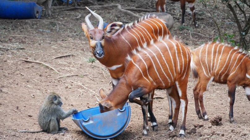
In an effort to protect the endangered Mountain Bongo, the Kenya Space Agency has launched a satellite-aided conservation initiative at Mt Kenya Wildlife Conservancy.
The initiative popularly known as Project Centinela is also being implemented in the Aberdares and Kakamega forests, which are inhabited by the rare Bongo antelope species.
Speaking during the official launch in Mt Kenya Wildlife Conservancy on Tuesday, conservation stakeholders said the satellite-based conservation efforts support advanced monitoring and protection of the Mountain Bongo habitats.
The project, which is being implemented jointly with Mt Kenya Wildlife Conservancy (MKWC) and Planet Labs, is expected to improve conservation planning through the use of high-resolution satellite imagery to monitor forest ecosystems and bongo habitats, leverage archived satellite data to establish historical baselines and guide restoration activities, utilise current satellite imagery to assess the present status of land cover and habitat conditions; and provide a foundation for predicting future changes in land cover, thereby supporting long-term conservation planning.
Kenya Space Agency Director Charles Mwang underlined the role of space science in supporting national conservation priorities.
“Project Centinela reflects the Kenya Space Agency’s mandate to apply satellite technologies to address real-world challenges. Through earth observation data, we are supporting evidence-based environmental management and strengthening institutional capacity for biodiversity conservation,’’ Mwangi said.
Planet Labs Chief Impact Officer Andrew Zolli said the project will focus on the need for timely and accessibility of satellite data for conservation outcomes.
“Daily Earth observation allows conservation partners to see change as it happens and respond with greater precision. Through Project Centinela, satellite imagery is supporting more informed habitat monitoring and helping translate data into practical conservation action,” Zolli said.
According to Mt Kenya Wildlife Conservancy Director Robert Aruho, satellite imagery will boost the Mountain Bongo breeding and rewilding programme.
“Project Centinela is crucial for Mt Kenya Wildlife Conservancy because it enables the monitoring of Bongo habitats with high precision through satellite imagery,” Dr Aruhos said.
At the same time he highlighted that the approach supports the measurement of restoration efforts and enhanced understanding of historical changes of the endangered species, guides on-going and future strategies for the breeding, re-wilding and long-term survival of the Mountain Bongo.
The scientists said the initiative demonstrates how partnerships between government agencies, conservation institutions and use of technology can advance the application of satellite-based data for biodiversity conservation and ecosystem restoration in Kenya.
- A Tell Media / KNA report / By Muturi Mwangi.


About author
