


Kenya is moving toward integration of newly launched natural assets inventory reports into national and county planning to safeguard critical ecosystems, strengthen climate resilience and promote sustainable development across Kenya’s arid and semi-arid lands.
Environment and Climate Change Principal Secretary Festus Ng’eno said the reports provide an evidence-based framework that will guide land use planning, environmental governance and investment decisions.
Ng’eno noted that Kenya’s drylands, which constitute nearly 90 per cent of the country’s landmass, are increasingly facing pressure from climate change, population growth, uncontrolled infrastructure development and competing land uses.
“These reports tell us where our natural assets are located, help us understand their condition, identify risks before they become crises and provide government, investors and communities with a common evidence base for better decision-making,” he outlined.
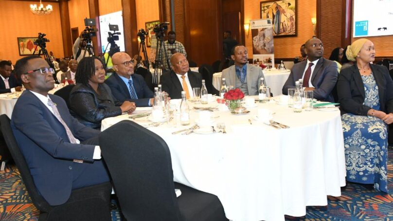
In a speech read on his behalf by Environment Secretary in the State Department of Environment and Climate Change Selly Kimoso during the launch of the Tri-County Natural Assets Inventory Reports that cover Isiolo, Samburu and Laikipia counties, the principal secretary stated that the national government is committed to restoring degraded landscapes and ensuring economic growth is pursued alongside the protection of natural capital.
“We cannot achieve sustainable development if we continue consuming nature faster than we restore it. Evidence-based planning is no longer a luxury but a necessity,” Ng’eno cautioned. He said the reports should guide county spatial plans, environmental impact assessments, budgeting and climate adaptation programmes.
Similarly, the principal secretary also underscored the value of indigenous knowledge, saying local communities possess generations of experience in managing grazing systems, water resources and biodiversity, which should complement scientific research in environmental conservation.
Earlier, National Land Commission Chair Abdillahi Saggaf Alawy said the inventory marks a significant milestone in strengthening sustainable land governance through collaboration between government institutions, county governments, researchers, development partners and local communities.
He said the initiative demonstrates that protecting Kenya’s natural heritage begins with understanding and documenting the country’s natural assets before development decisions are made.
“The work has only just begun. These reports should not remain on the shelves, but must become practical tools for planning, conservation and decision-making that benefit present and future generations,” the chair said.
Alawy pointed out that safeguarding natural resources is a shared responsibility requiring the participation of government agencies, communities and individual citizens to ensure development does not compromise ecosystems that support livelihoods.
During a technical presentation, NLC Director of Research and Natural Resources Ben Opaa said the inventory established that Kenya’s arid and semi-arid lands hold enormous ecological and economic value despite often being perceived as wastelands.
He revealed that the three pilot counties contain extensive natural resources, including rivers, springs, wetlands, rock catchments, wildlife corridors, grazing reserves, forests and natural salt licks that are essential for biodiversity conservation, livestock production and community livelihoods.
Equally, Opaa announced, the exercise combined geospatial technology with indigenous knowledge to map and document natural assets through an inclusive, community-driven approach.
“The inventory recorded hundreds of water resources, wildlife habitats, grazing routes and ecological corridors across Isiolo, Samburu and Laikipia, providing data that will support county spatial planning, land registration, conflict prevention, climate adaptation and ecosystem restoration,” the director explained.
He warned that climate change, land fragmentation, infrastructure expansion and competing land uses are a threat to these ecosystems, which makes accurate mapping and legal protection increasingly urgent.
Opaa recommended integrating the mapped natural assets into county spatial plans, community land registration processes and legal protection frameworks while strengthening cross-county collaboration to conserve interconnected ecosystems.
Meanwhile, the reports and accompanying participatory mapping methodology are expected to serve as a national model for documenting and protecting natural assets in Kenya’s remaining arid and semi-arid counties.
- A Tell Media / KNA report / By Zipporah Odionyi and Sharon Njeru


About author